Brewery Creek and Reavers Lane - Natural Hazard Review
About the Natural Hazard Review
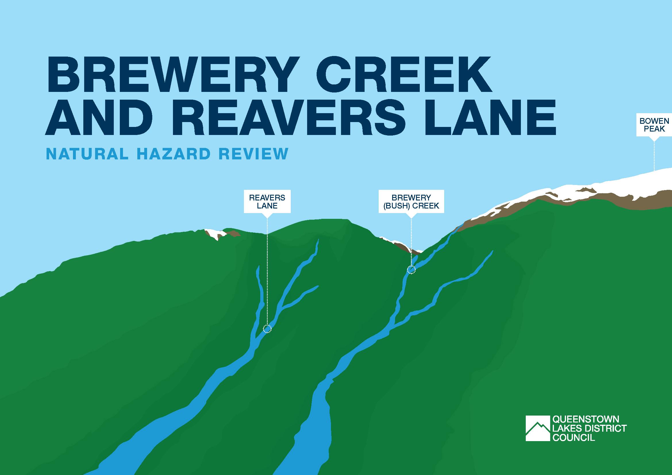
Queenstown Lakes District Council (QLDC) has been investigating risk from natural hazards in the Brewery Creek and Reavers Lane areas. Assessments show there is a range of risk levels in these areas, with elevated levels of risk in some places. We've also been investigating potential options for managing this risk to ensure that people and property are safe.
Preferred response package
Using all the information collected to date, a preferred response package has been developed to manage rockfall and debris flow risk across Brewery Creek and Reavers Lane. This package was endorsed by Councillors at the Thursday 30 June Full Council meeting. Endorsement of the package signals Councillor support for the different elements that make up the preferred response package and a further work programme to develop the package. The preferred response package addresses risk to life and property from rockfall and debris flow hazards, and brings together different elements of the four original risk management options Council and the community has previously considered.
Click here for a summary of the preferred response package and the elements proposed to manage rockfall and debris flow risk across Brewery Creek and Reavers Lane.
The further work programme will need to be undertaken to inform where different elements recommended by the preferred response package will be applied, and their detailed design. This work will need to be progressed before the costs and benefits of the preferred package are fully understood, and before the package can be ready for implementation. Importantly, further decisions will be needed from Councillors ahead of any on the ground implementation of the package.
What's next?
Council staff are now working on a further work programme to inform where the different elements recommended by the preferred response package will be applied, and their detailed design. This further work will address engineering, legal, financial, and funding matters, as well as responsibilities for and the timing of implementation.
Detailed planning and scheduling of the further work programme is estimated to take 18 – 24 months to complete, before the preferred response package will go before Councillors to decide on its implementation.
Want to stay in the loop?
We're launching a newsletter to share updates on the further work programme as it progresses. Sign up to receive your own updates here.
Got a question?
If you have any questions on the consultation report, technical information, the preferred response package, or the next steps for the natural hazards plan review, QLDC staff are available to answer any questions. You can ask your question at the bottom of this page and we'll get a member of our Planning team to respond as soon as possible, or fire us an email at letstalk@qldc.govt.nz and we'll respond via email.
Ask a Question
Got a question about natural hazards in the Brewery Creek and Reavers Lane areas? Ask it here and a member of QLDC's Planning team will respond as soon as possible.
Photos
Documents
-
 QLDC_Gorge Road Natural Hazards_Preferred Response Package_Jun22.pdf (2.67 MB) (pdf)
-
QLDC Public Engagement on Risk for Brewery Creek and Reavers Lane - Summary of Consultation Process and Findings[March 2022].pdf (769 KB) (pdf)
-
Gorge Road Natural Hazards - Summary (3.42 MB) (pdf)
-
Gorge Road Natural Hazards 30 June 2022 Full Council Report
-
Map of Areas Under Review (2.08 MB) (pdf)
-
Interactive Annual Individual Life Risk Contour Map
-
 Technical Assessments
-
Beca Risk Assessment Report – Executive Summary
-
Beca Risk Assessment Report – Full Report (41.5 MB) (pdf)
-
Beca Risk Assessment Slope Stability Annual Individual Life Risk Contour Maps
-
Beca Engineering Options Report
-
GNS Science Debris Flow and Rockfall Loss Modelling Report
-
Market Economics Social and Economic Impacts Assessment
-
-
'Hear about the Hazard' Technical Information
-
Loss Modelling (1.39 MB) (pdf)
-
Risk Assessment [A] (6.07 MB) (pdf)
-
Risk Assessment [B] (3.75 MB) (pdf)
-
Risk Assessment [C] (1.09 MB) (pdf)
-
Options to Respond (39.9 KB) (pdf)
-
Engineering Options Assessment [A] (3.84 MB) (pdf)
-
Engineering Options Assessment [B] (58.8 KB) (pdf)
-
Debris Flow and Rockfall Loss Modelling (1.46 MB) (pdf)
-
Costs & Benefits Analysis (111 KB) (pdf)
-
Social Outcomes [A] (79 KB) (pdf)
-
Social Outcomes [B] (110 KB) (pdf)
-
Social Outcomes [C] (110 KB) (pdf)
-
Videos


Risk Map

FAQ
-
Preferred Response Package
- What is the preferred response package?
- Where will the different elements of the preferred response package apply?
- How has the preferred response package been developed?
- When will the preferred response package be implemented?
- What further work will be undertaken to support the preferred response package?
-
The review
-
What have we found out so far?
-
What is QLDC doing about high levels of risk?
- What technical assessment has QLDC commissioned?
- What options have been considered to manage natural hazard risk?
- What did we find out about the engineering options?
- What did we find out about how the original options would reduce property damage and losses?
- What did we find out about the economic impacts of the original options?
- What did we find out about the social impacts of the original options?
- How will QLDC make a decision on the review?
-
Public consultation
-
About natural hazards and risks
- What do you mean by 'risk'?
- What do you mean by 'managing’ risk?
- What is AIFR?
- Are these the only alluvial fans in the District?
- Does rockfall mean individual rocks or an avalanche?
- Does the assessment of liquefaction take into consideration the old rubbish tip?
- What about insurers? What does this mean for my property value?
- How will climate change affect the levels of risk?
- How do the trees in the catchments of the Reavers Lane and Brewery Creek fans affect the levels of risk?
-
Other questions about the process